• Required reading for all forum users!!!

    Welcome!
    Register to access the full functionality of the GSResources forum. Until you register and activate your account you will not have full forum access, nor will you be able to post or reply to messages.

    A note to new registrants...
    All new forum registrations must be activated via email before you have full access to the forum.

    A Special Note about Email accounts!
    DO NOT SIGN UP USING hotmail, outlook, gmx, sbcglobal, att, bellsouth or email.com. They delete our forum signup emails.

    A note to old forum members...
    I receive numerous requests from people who can no longer log in because their accounts were deleted. As mentioned in the forum FAQ, user accounts are deleted if you haven't logged in for the past 6 months. If you can't log in, then create a new forum account. If you don't get an error message, then check your email account for an activation message. If you get a message stating that the email address is already in use, then your account still exists so follow the instructions in the forum FAQ for resetting your password.

    Have you forgotten your password or have a new email address? Then read the forum FAQ for details on how to reset it.

    Any email requests for "can't log in anymore" problems or "lost my password" problems will be deleted. Read the forum FAQ and follow the instructions there - that's what we have one for...

  • Returning Visitors

    If you are a returning visitor who never received your confirmation email, then odds are your email provider is blockinig emails from our server. The only thing that can be done to get around this is you will have to try creating another forum account using an email address from another domain.

    If you are a returning visitor to the forum and can't log in using your old forum name and password but used to be able to then chances are your account is deleted. Purges of the databases are done regularly. You will have to create a new forum account and you should be all set.

Eastern US Mountain Riding Adventures!

Chuck78

Forum Sage
Past Site Supporter
Being in (fairly flat) central Ohio, the Appalachian plateau foothillls start rising up to fun and scenic proportions about 45 minutes or an hour Southeast or East of me... and there are a TON of GREAT motorcycle roads down that way that beat out the offerings of 75% of the rest of the USA for sure...
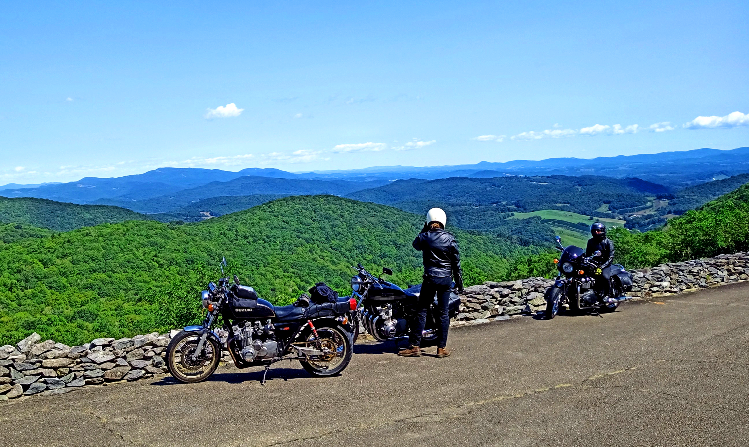
But wow, I LOVE getting out deeper into the Appalachian/Alleghany area into the real mountains that run from the Northeast corner of West Virginia, and the entire Virginia border with West Virginia down to the SW tip of Virginia, as well as Eastern Tennessee and Western North Carolina... which is EXACTLY what my buddy Brent and I did on our GS750's Friday through Wednesday over an extended Labor Day weekend! I had put only 2 miles on my bike since the beginning of June, when my wife and I returned from a NE West Virginia Monongahela National Forest backcountry trip. Sad moto year or two for me, really... been gimping around for 2 years now after a nasty nasty knee injury and surgery, but mostly back in action now.

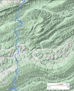
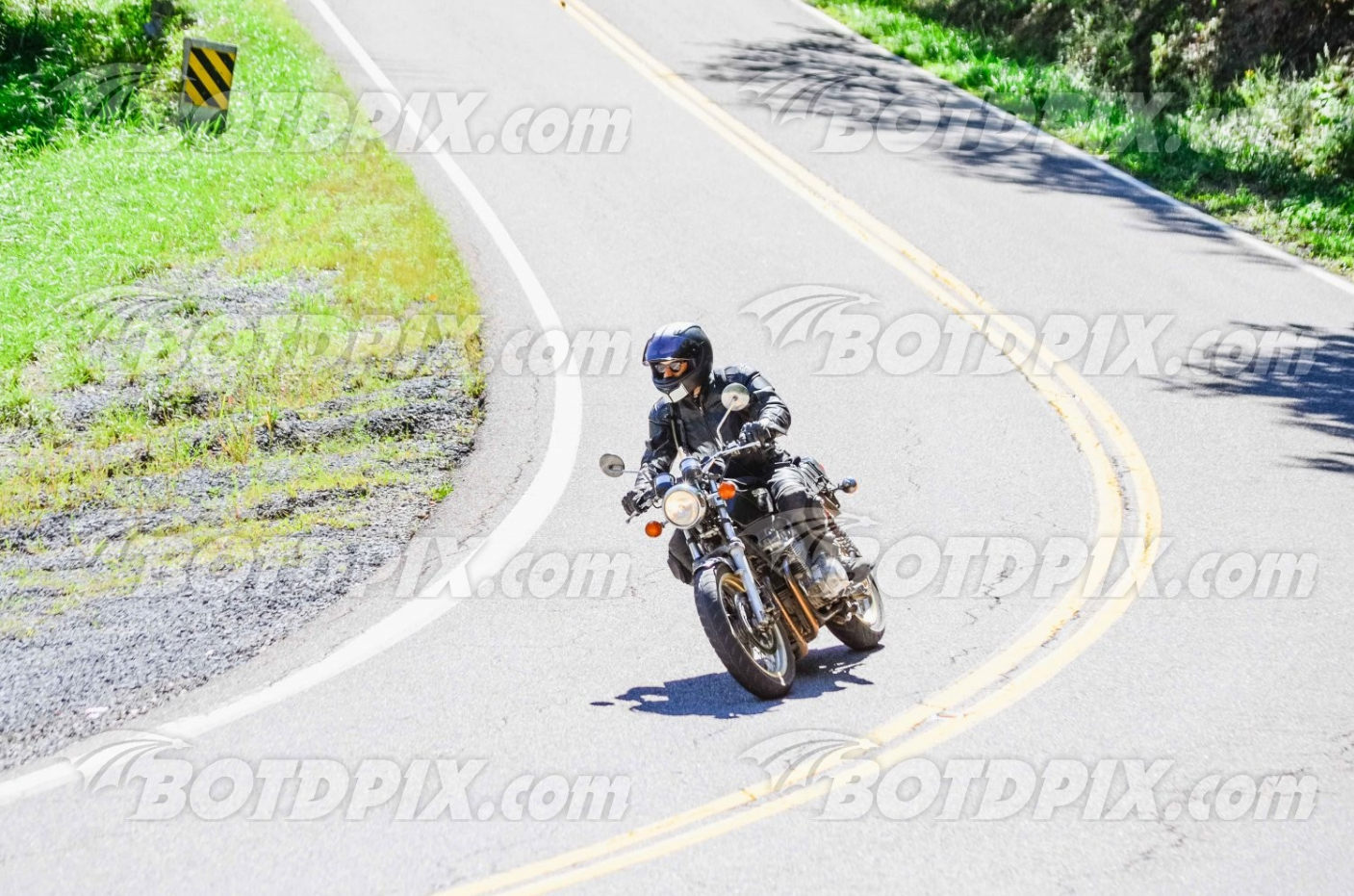
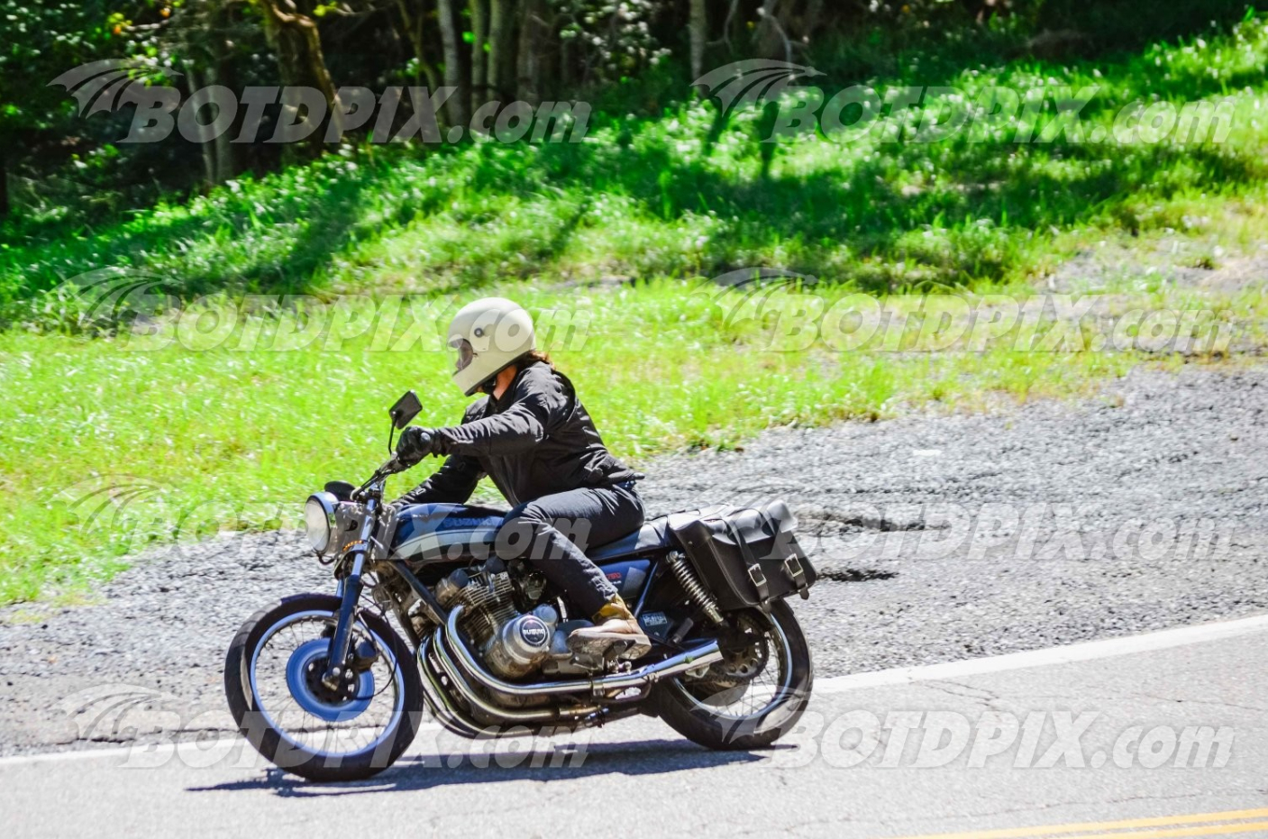
Here's a few photos from Route 16 between Tazewell and Marion Virginia, directly south of West Virginia in the Southwestern sliver that is the far edge of Virginia. Same Ridge & Valley mountains that we love to frequent in NE West Virginia and the Virginia border regions of WV...
I'll cut and paste my top routes from an email I sent to my buddy Grant as well.

BOTD_9-5-2020-c by chuck_lambert78, on Flickr

BOTD_9-5-2020-g by chuck_lambert78, on Flickr

BOTD_9-5-2020-h by chuck_lambert78, on Flickr


BOTD_9-5-2020-a by chuck_lambert78, on Flickr

BOTD_9-5-2020-b by chuck_lambert78, on Flickr


My wife joined us Saturday evening through Monday morning, solo trooper, she has ridden coast to coast and so many more long hauls than either Brent or I have... I go straight for the twisties, she rides long hauls cross country whenever the opportunity arises... like-new $4,000 2004 Triumph Bonneville 790cc. Nice compact fun bike! No power down low like I'd expect though, needs 2-1 pipe, jetted, K&N, and ignition re-map/rev limiter mod. Takes off well 4,000-7,000rpm though and handles great!
Needless to say, there is a stainless 2-into1 pipe, Dynojet kit, and K&N airbox filter for the Triumph sitting on the table awaiting my assistance now! At least she didn't throw a few years newer 865cc cylinder and piston kit from a 2007+ Triumph at me (YET!)! Very nice bikes with those mods. I think 2008+ or 2009+ began the fuel injected era, only a year or 2 of 865cc AND carbs.

BOTD_9-7-2020-a by chuck_lambert78, on Flickr
 
Last edited:
And yes, those are the promo low resolution versions of the professional photographer photos that are now available for yet another of the Eastern USA giants as far as amazing roads - I plan to purchase the best 2 or 4 of the bunch, loaded in my shopping cart awaiting any sort of Advance Auto Parts type discount offer that they may or may not send 24-48 hours after you leave things in your cart!).
The Back of the Dragon from Thompson Valley, VA to Hungry Mother State Park north of Marion, Virginia is one heck of a ride, with about as many curves (230) as the Tail of the Dragon (advertised at 311 curves in 13 miles, I counted, it's more like 220 noteworthy curves in reality for US129 the Tail of the Dragon). 3 mountains and 2 valleys, with about 3 of the 6 mountain climbs/descents to the ridges being of absolute epic proportions with steep grades and beautifully sculpted tight tight curves! That's what the Tail of the Dragon lacks, the steep grades and some of the most incredibly tight of curves on the steep slopes... Route 16 in this stretch climbs up over 1000-2000ft tall mountain ridges, and is very awesome... the highest elevation on the road is around 3500ft, not nearly the highest in this area (5600ft? just south of there at Mt Rogers and Whitetop Mtn as well as some other peaks/ridges nearby), but is definitely one of the most exhilarating!
US129 Tail of the Dragon and VA-16 Back of the Dragon are both MUST RIDES, however...

Honestly, I think Route 16 is one of the absolute best long distance twisty roads around in the USA, particularly the Eastern USA, in terms of fun curves and great scenery... all the way from the Ohio River at St Mary's WV down to Georgia... From Ohio, taking WV-47 from Parkersburg to WV-16 (@ Smithville?) is EXCELLENT, then stay on WV-16/VA-16 all the way through both states until you get to the crossroads/general store-gas station at US-58 "The Mighty Python" near the southern border of Virginia... US-58 is at the base of the mountains with no major elevation changes, but WOW is this an INCREDIBLE ROAD!!!! after the Beartree Recreation area and campgrounds, towards Damascus, VA, there are about 5 or so roadside campsites, unofficial of course, but all in Cherokee or Jefferson National Forest, and that stretch as well as one or two shorter stretches earlier on just south of Grayson Highlands have some AMAZING graceful knee dragger type sections of beautifully sculpted curves back to back to back to back to back..........
 
Last edited:
We honestly did not expect to run into Killboy type photographers down there on Route 16, but it's gained massive popularity/publicity as a motorcycle destination in the past year since my last visit. They have a Back of the Dragon welcome center and coffee shop/cafe in Tazewell now even, there were about 60 cruiser-types hanging out there when we gassed up next door in Tazewell...
There was a couple in front of us on a big dresser/bagger holding us up on this northernmost section where the photographer was, so I sadly was not able to ham it up and toss the bike over into a deep lean when faced with the surprise of a pro photographer! Luckily the caravan of 50-60 Harleys we passed were going the opposite direction... slow-moving roadblocks!!!

Worst part of the trip for us was 2/3 of our time on the Blue Ridge Parkway...frustrating being behind caravans of 30mph cars on a 45mph road that is most fun 45-55mph! I was in a hurry trying to get to my favorite, TN-32, otherwise I would have taken my own best advice and just pulled over at a good scenic overlook and taken in the view, allowing the slowpokes to get ahead a few minutes, so that we could ride for 5 minutes at a fun speed before catching up to them again!
There was a Sysco food service semi-truck that was "trimming trees" on the Blue Ridge Parkway for quite a ways before we finally got to the once every 20 miles passing zone... clearly he should NOT have been on the BRP, as he was ripping tree branches down all over, since it is a tourist road and not a commercial deliveries type road...

We hiked Linville Gorge and that is near where we got on the BRP at. Linville Gorge or Little Switzerland is a GREAT starting point, I can't phathom riding the entire BRP unless I was 80yrs old and no longer having a serious thirst/lust for adrenaline... but the scenery south of Little Switzerland to Asheville, and from Asheville to the US-19/Maggie Valley intersection of the BRP is THE BEST... and also the highest elevation. from Maggie Valley to the Smoky Mtns National Park / Cherokee NC is decent, but all downhill, and the Smokies are not for spirited riding after that, just incredible scenery and hiking/camping. the US-440 speed limit (the only main road through the Smokies) is 25mph the whole way, FYI.
 
Here's a link of one of my favorites routes in the Eastern USA... More to come later, just uploaded a dozen more photos to my Flickr:

https://goo.gl/maps/SNmDWwGzerePREg4A

That's all the points Google will let me plot in one map link, but we usually head out of Parkersburg WV on the Ohio River / Ohio border on WV-47 eastbound, and catch WV-16 just a little ways south of St Mary's WV, also on the Ohio River. 47 has some good twisties, and I think Dale Dogma or Steve tipped me off on that years ago, one of the Dayton/Cincinnati GS Resources veterans.
16 is Great to Gauley Bridge / Fayetteville, bit is a bit of a drag through Oak Hill / Beckley, probably the largest major metropolitan area in WV aside from Charleston, perhaps bigger than Parkersburg and Huntington as well (both of those are on the Ohio River). It's advised that if you aren't needing to stop for any supplies or parts in Beckley, that you take a bypass around the area on 19 and 41 I believe it is? East of Beckley.

South of Beckley, 16 heads a bit west. I try to detour off of Odd Rd / 19 and hit Coal City Rd northbound, and then turn around at the last hairpin at the edge of Coal City, and then back southbound onto Odd Rd the other direction, Westbound. Then I link back up to 16 after a short while. WV-10 also has some killer stretches, but to hit that to US-52 (?) to WV-16, you skip the best of the southern portions of WV-16... South of Welch, WV, the Head of the Dragon stretch of WV-16 there, south of the Google reference point of Vic Nystrom Stadium, WV-16 has some wickedly tight curves in two stretches in this vicinity that are AWESOME, and right up my alley... TIGHT 15mph curves that are VERY exhilarating at a max speed of 25-30mph at the most... my kinda curves! They really leave me wishing I had a GS550/650 or GS650E together, as the 750/1000/1100E stator cover hangs out so far that I have been scraping it a little on roads like this, as well as grinding the tip of my left boot soles pretty harshly when I leave my foot under the shifter in tight left hand curves!!!!!

After that, you have to plot Cucumber, WV for Google to keep you on 16, as it tries to send you down a road into the Berwind (?) Wildlife Management Area as a google shortcut. Either is good, but staying on 16 is good and easier to navigate.
16 is real nice south of there all the way across the border into Tazewell, VA. Take a R on the 16 truck route / bypass at the first intersection/gas station in Tazewell unless you want to do and east-west U-turn loop through the town on the main drags.

THEN after you go through Thompson Valley (basically a named crossroads & also obviously the name of the valley), you'll come up on the first southbound slope and quickly climb up through a minimal amount of tight curves to the ridge. This is where the BOTDpix.com photographer was set up. Probably 8 or 12 nice curves up this side of the mountain. It's fairly mellow and easily navigable.
After that, the decent down Clinch Mountain from the first ridge is above average, and then you almost immediately arrive at the next mountain which is VERY EXCELLENT on both sides up and down, north slope and south slope! Very minimal valley between these.
The next valley is a little bit bigger, but the southernmost mountain has a wicked north slope climb with the tightest this section of road has to offer. doing it northbound is significantly tighter, so I prefer to do this route southbound, but due to it's 23-33 mile length (depends on where you start counting from, average vs world class twistiies), we usually hit it both directions depending on where our basecamp is! The southernmost mountain's south slope looks wicked on the map, but is not jam packed with nonstop twisties like the 3 or 4 slopes to the north of it, but is still pretty darn great, and looks very impressive on the maps with a snaggletoothed wild switchback that a guy on a Suzuki GS with a red tank and red/orange OEM striping was photographing Brent and I on our GS750's when we were headed northbound through the Back of the Dragon on Sept 5th afternoon!
iirc the other two mountains are Big Walker Mountain, and Brushy Mtn or Little Brushy Mtn.

attachment.php
attachment.php


The mapped route linked above takes 16 down to US58 the Mighty Python, a route through the base of the mountains, that is absolutely splendid and soooooooo flowing and superb all the way to Damascus, with 2 or 3 amazing sections of curves. It also goes past the hightest elevation peaks in Virginia, Whitetop Mtn and Mt Rogers, and the adjacent Twin Peaks of Haw Orchard Mountain at Grayson Highlands State Park, which provide great views from two rocky overlooks that are a pretty short easy hike from the furthest parking area in the park. Massie's Gap is a highly recommended trail to catch more great views, which is just before that dead end of the park rd at the twin peaks area.

From there, continuing to Damascus VA on US58, you can cut north to Rt 80 and up and over a nice mountain with some killer twisties, and then make a stop for a 6 mile out and back hike to an old firetower and then the slot canyon like rock maze known as the Great Channels of Virginia. This area is magical, and has it's own microclimate in the maze of splits in the rocks on the mountaintop. The crevices are nearly 20ft deep and present a wonderful maze of extensive passages to explore. Climbing to the tops yields excellent panoramic views as well, but is maybe 100ft lower elevation than the base of the fire tower.

From there and back to Damascus, take a road out of Damascus that turns into TN-133 at the state line, and goes through Backbone Rock. I camped at the Backbone Rock primitive campground last year on my way to Barber, and it was fantastic aside from being roadside basically. the creek and small falls behind it drowned out the sporadic vehicle noise however. through the Backbone rock road passage, there is parking for a beautiful cliff gorge and wading/swimming hole, and then down a few hundred feet from there, there is a nice cliff waterfall 300ft off the road with a nice loop trail back to the gorge trail, LOTS of stairs to climb this way, cut into the rock or laid out with large flat natural rock slabs.
From there, go all the way to the Shady Valley crossroads, and hang a right on US421 and take it over a mountain and to the lake. Turn around at the boat launch parking lot, rip it over the same mountain again and cross 133, and hit another fantastic mountain filled with more excellent mountain twisties. Slow down near the end as you will be into a residential area and then into Mountain City, TN, where you can head further south and east into lots more mountains of Pisgah National Forest, Cherokee National Forest, Smoky Mountains National Park, and Nantahala National Forest, among others. I think there are at least 1 or 2 other National Forests in the adjacent connected mountain ranges in this area.
 

Attachments

  • BackOfTheDragon.jpg
    BackOfTheDragon.jpg
    99.5 KB · Views: 0
Last edited:
Hey Chuck, glad to see you're hitting it! Yes there's a Tazewell Tennessee, it's just north of Knoxville. Yes, definitely some nice riding in that part of the United States. I'm definitely going back next summer. Wasn't that Labor day weekend's weather just perfect! Cool, sunny, with low humidity. 👍
 
Grayson Highlands overlook halfway up to the top of the roadways through the State Park:

signal-2020-09-10-134616 by chuck_lambert78, on Flickr

Just over the ridge of Clinch Mtn to a gravel overlook at the beginning of a forest service road that goes deep into the backcountry of Jefferson National Forest, with the Beartown Wilderness Area to the left of the gravel road for 15+ miles... I will hike Clinch Mtn to the top of Beartown overlooking the giant mountain bordered crater known as Burke's Garden... one of these days soon!

signal-2020-09-10-134347 by chuck_lambert78, on Flickr

Pretty much everywhere I strive to go to on motorcycle or for camping/hiking in the Eastern USA Appalachian/Alleghany/etc mountains has views like this (first of the two twin peaks vistas on Haw Orchard Mtn, Grayson Highlands, VA):

PSX_20200913_154651 by chuck_lambert78, on Flickr

and more views like that, which my dreams are made of:

signal-2020-09-10-133943 by chuck_lambert78, on Flickr
 
Aside from the more southern stretches we touched on with this trip, some of my other other favorite eastern US mountain pass twisties are in the Monongahela National Forest area including US33, US250, Smoke Hole Rd, Sugar Grove Rd, Reddish Knob Rd, etc... Nearby WV-15, WV-20, and WV-39 as well. All in the Monongahela vicinity. Moyer's Gap Rd off of Sugar Grove Rd as well... and US-219!

TN32 linked to 209 "The Rattler" and others beyond the Hot Springs NC area are AWESOME, and 32 borders the Smoky Mtn National Park backcountry areas as well as Cherokee National Forest on the other side of the road! A few good roadside backcountry campsites in this vicinity. 32 is my favorite road ever, too tight for most people, but I LOVE IT TO THE EXTREME!!! 9 miles of endless TIGHT TIGHT CURVES back to back to back to back to back to back to back... WICKED! way tighter than US129 Tail of the Dragon... not for everyone though, highly highly technical...

Little Switzerland 226/226A loop HAS BRAND NEW & 2-year-old pavement!!!! It is AWSOME and technical now, compared to my last visit!
NC Rt 80 over the BRP & jogging on Route 19E a few miles to the section of 80 north of 19 up to 226 or 226A is AMAZING! the more low-elevation section north of 19E up to 226A is very much like US58 the Mighty Python - endless graceful moderately tight curves nonstop, where I achieved a record amount of grinding my left boot on the pavement in left hand curves...we hit this 3 times on our 6 day adventure!!!

NC-215 / US-276 criss crossing each other and both seperately climbing up the mountain to the Blue Ridge Pkwy is EXCELLENT, and many waterfalls in this area, as well as Looking Glass Rock near the roadslde Looking Glass Falls and Sliding Rock Falls all off US276 on it's eastern slope of the mountain... linked up to each other at the base of the eastern slopes on paved & gravel forest service roads in the BRP area...

US129 Tail of the Dragon / Rt 28 the Hellbender / Moonshiner are all in the tops of course...

The Cherohala Skyway is nice but not terribly thrilling unless doing 90mph through most of it. I prefer to hop off and take River Rd far below it, a nice forest service road with very gorgeous scenery down at the base of the mountains in the remote backcountry. Not a thrilling twisty road, but an amazing change of pace after seeing so many BRP/Cherohala and other overlook vista views for days and days...


I haven't visited the central WV roads much for a while, I need to revisit those. WV15 WV20,WV39...Rode Proctor Creek Rd WV with my wife last fall or maybe this past May, its more Marietta Ohio twisties area than WV twisties routes, it also RULES...

Also hit some wicked backroads in TN/NC thanks to LoMaps (Open Street Maps optimized for the Locus Maps App), learning to read the road quality/surface type&width off those maps for county backroad ripping... I was blown away by the road to our 2nd campsite, which based on Google, I was sure was a treacherous gravel switchback road. Turns out it was double yellow striped and wicked! LoMaps road line-marking (on the maps) designation has helped me know the width and surface types/conditions very well, so I was able to plot a much shorter distance/longer time route to Linville Gorge on some nice paved wickedly twisty low speed backroads that NC is FILLED WITH, that I would have never known to hit if I were just casually using Google without zooming in extensively in satellite view to see the double yellow striped centerlines to know that it was a highly worthy "shortcut" for more fun, more twisty time, and a shorter distance than the major state routes... Locus Map App is AWESOME for offline route planning and navigation. Make sure to download the BRouter or GraphHopper offline routing app add-ons and properly set your Locus settings for which one you chose. And download LoMaps for the states you plan to use. I got them mostly all for free with the map credits included in the $3.99 purchase price for the premium version for Ohio, Kentucky, West Virginia, Virginia, Tennessee, and North Carolina... all I need, the portions of those states in the hill sand mountains are my stomping grounds!
 
I will agree that some of the best riding in the mountains is off the highways and away from the pirate parades and roads with stupid names.

I guess roads with stupid names do serve the purpose of attracting the crowds of wobbly idiots and keeping them away from the "real" good stuff.

I've also learned that idiots just can't get up early; if you want to travel the "Sinuous Critter Byway", just do so before 10am and you'll have it nearly to yourself while the idiots sleep off some of their hangovers. Might be a few leather-clad knee draggers, but they usually don't get in the way. Go on a weekday and it'll be nearly deserted.


And if you're on a dual-sport bike, or at least don't mind gravel, the options and opportunities for fun in the mountains expand immensely. I haven't been down there on a streetbike in several years.
 
Last edited:
Was in the Waynesville area a week before memorial weekend. Due to covid we had that whole area to ourselves. Absolutely the best riding I've ever experienced and we running off of DeLorme paper maps. A tropical storm that rolled up from the gulf that kept circling chased us out. Had the BRP to ourselves, Saw 1 car on the Dragon. Next time Im bringing the Speed Triple
 
Back
Top