EDIT: I started this thread just for one ride I wanted to do, but that has long since passed, and I turned this into a wealth of information on really fun twisty scenic Southeast Ohio routes.
I mapped out three tentative 2014 route maps that I plan to do, if anyone cares to join me, I may post on GSR for any interest.
I am always heading out of Columbus, OH, so the routes start at the beginnings of the hills 35 minutes south of here or from points south/east of Columbus off of US-33.
11/16/2013 ride:
https://www.google.com/maps?saddr=I-70+E&daddr=E+Canal+St+to:OH-685+to:OH-685+to:Broad+St+to:7th+St+to:W+Court+St+to:OH-26+S%2FOH-800+S+to:OH-255+E+to:OH-800+N+to:OH-26+S%2FOH-260+S+to:Greene+St+to:OH-676+W+to:OH-555+N+to:OH-669+W+to:OH-669+W+to:OH-204+W+to:OH-204+W%2FBlacklick-Eastern+Rd+NW+to:Blacklick-Eastern+Rd+NW+to:Cole+St&hl=en&ll=39.681826,-81.936035&spn=1.665637,2.463684&sll=39.493444,-81.911316&sspn=1.670171,2.463684&geocode=FTikYQIdsh0O-w%3BFRz4WQIdUmcZ-w%3BFQwsWgIdbhYa-w%3BFYMpWgIdXlkb-w%3BFZzdWgIdtaIb-w%3BFbAOXQIdeOce-w%3BFUO7XgIdy0Qq-w%3BFcFCXgIdE0kq-w%3BFSHOXAId9FAt-w%3BFf3UXQIdB6Aq-w%3BFd-uWwIdneUo-w%3BFSNcWQIdZiQl-w%3BFfwlWgIdufIh-w%3BFcC3WwIdHkId-w%3BFVZKXgIdjCMc-w%3BFX0zXwIdYosa-w%3BFXv2YAIdeHQX-w%3BFbPjYAIdIZkS-w%3BFehFYQIdYr8Q-w%3BFUamYQIdXyYO-w&t=h&mra=ls&z=9
local thread on this route plan:
http://ohioriders.net/index.php?/to...woodsfield-then-26-vs-255-7-260-26/?p=1363248
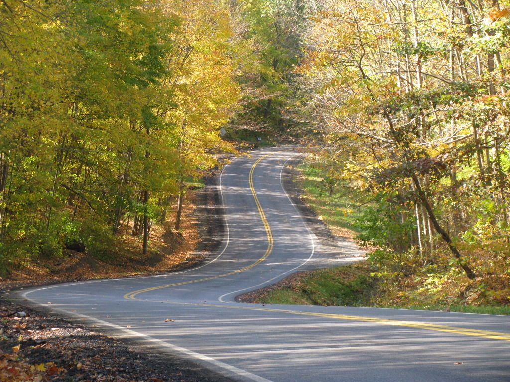
There are a TON of awesome twisties to explore in Southeast Ohio, just go to google maps, click the "Terrain View" option in the map layers menu, and you can see where the hills start in eastern and southern Ohio, just zoom in and pick your routes on the interesting looking winding roads!
I mapped out three tentative 2014 route maps that I plan to do, if anyone cares to join me, I may post on GSR for any interest.
I am always heading out of Columbus, OH, so the routes start at the beginnings of the hills 35 minutes south of here or from points south/east of Columbus off of US-33.
11/16/2013 ride:
https://www.google.com/maps?saddr=I-70+E&daddr=E+Canal+St+to:OH-685+to:OH-685+to:Broad+St+to:7th+St+to:W+Court+St+to:OH-26+S%2FOH-800+S+to:OH-255+E+to:OH-800+N+to:OH-26+S%2FOH-260+S+to:Greene+St+to:OH-676+W+to:OH-555+N+to:OH-669+W+to:OH-669+W+to:OH-204+W+to:OH-204+W%2FBlacklick-Eastern+Rd+NW+to:Blacklick-Eastern+Rd+NW+to:Cole+St&hl=en&ll=39.681826,-81.936035&spn=1.665637,2.463684&sll=39.493444,-81.911316&sspn=1.670171,2.463684&geocode=FTikYQIdsh0O-w%3BFRz4WQIdUmcZ-w%3BFQwsWgIdbhYa-w%3BFYMpWgIdXlkb-w%3BFZzdWgIdtaIb-w%3BFbAOXQIdeOce-w%3BFUO7XgIdy0Qq-w%3BFcFCXgIdE0kq-w%3BFSHOXAId9FAt-w%3BFf3UXQIdB6Aq-w%3BFd-uWwIdneUo-w%3BFSNcWQIdZiQl-w%3BFfwlWgIdufIh-w%3BFcC3WwIdHkId-w%3BFVZKXgIdjCMc-w%3BFX0zXwIdYosa-w%3BFXv2YAIdeHQX-w%3BFbPjYAIdIZkS-w%3BFehFYQIdYr8Q-w%3BFUamYQIdXyYO-w&t=h&mra=ls&z=9
local thread on this route plan:
http://ohioriders.net/index.php?/to...woodsfield-then-26-vs-255-7-260-26/?p=1363248
There are a TON of awesome twisties to explore in Southeast Ohio, just go to google maps, click the "Terrain View" option in the map layers menu, and you can see where the hills start in eastern and southern Ohio, just zoom in and pick your routes on the interesting looking winding roads!
Last edited: